The water system of the Rostov region is related to the basin of the Azov Sea. Among the rivers of this region, only 3 rivers are navigable in the full sense of the word. Don, Manych, as well as Seversky Donets are suitable for the transportation of goods by water. The rest of the streams are not so deep, but they also have a lot of advantages. The region's river network covers more than 24 thousand km.
Most of the local rivers have their source on a hill and a narrow valley. Many streams and streams dry up completely in the summer months. This is due to the hot climate of the region. The Rostov waterways are characterized by a mixed diet: snow and rain. The water regime of the rivers is expressed by spring floods and summer low-water periods. Small and meandering water formations of the Rostov region are regulated by dams and reservoirs. The region ranks third in the ranking of the length of the river system.
The longest rivers of the Rostov region
List, photo with names and descriptions of the largest rivers in the region.
Don
The source of the river is worth looking for in the Central Russian Upland. The water area is 422 thousand km². There are such large cities as Voronezh and Rostov along the river. The Don is considered a typical flat river. The Don refers its waters to the basin of the Azov Sea. It feeds on numerous tributaries, snow and rain. The water regime of the river is characterized by spring floods and a stable water level at other times of the year. The Don is a navigable river where fishing is carried out. Another waterway is actively used for tourist purposes.
The length of the river is 1870 km, in the Rostov region - 482 km.

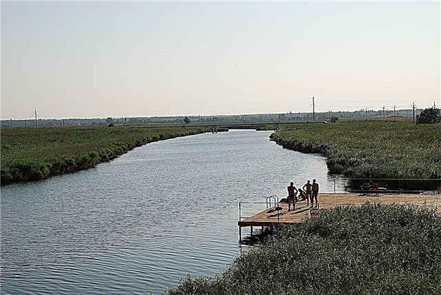
Seversky Donets
The border river passing through the territories of Russia and Ukraine is the right tributary of the Don. The water area is 98 thousand km². The source is located on the Central Russian Upland. The waterway is an important source of fresh water for both Russia and Ukraine. In winter, the river freezes over. The channel has many tributaries, oxbows, small lakes and reservoirs. In Russia, the river is navigable to the city of Donetsk in the Rostov region. More than 40 species of fish are found in the river.
The length of the river is 1053 km, in the Rostov region - 271 km.

Don't miss: the main attractions of the Rostov region.
Jurak-Sal
The river from which the Sal watercourse flows out on the lands of the Rostov region. The catchment area is 21 thousand km². The left tributary of the Don originates in the Ergenenskaya Upland. The upper reaches of the waterway pass through the dry steppe. High water occurs only in spring. The type of food is snow. Translated from the Turkic language, "Sal" is interpreted as "high-spirited". There is no navigation on the river, as well as no industrial fishing zones.
The length of the river is 798 km, in the Rostov region - 230 km.

Sal
The left tributary of the Don originates on the slopes of Ergeni. The basin area is 21 thousand km². The river flow is small, some parts of Sala are swampy. The shallow channel is fed by groundwater, rain and melting snow. The river is related to the Don basin. The river floods in March. The waterway is not navigable, and water tourism is not developed on it.
The length of the river is 776 km, in the Rostov region - 545 km.

Egorlyk
The river flows into the Proletarskoe reservoir. The basin area is 15 thousand km². It is related to the Don water area. The slow and steppe river has its source at the Strizhament mountain. The Egorlyk hydroelectric power station operates on the river, there are also several reservoirs. The type of food is mixed. In Yegorlyk canal catfish, minnows, perches and other river fish species are found.
The length of the river is 448 km, in the Rostov region - 160 km.

Manych
The left tributary of the Don passes through the Rostov and Stavropol regions, as well as Kalmykia. The water area is 35 thousand km². The source is at the Kalaus River. The Manych channel is notable for the fact that it contains brackish lakes fed by groundwater. At 179 km, counting from the mouth, the river is navigable. Manych is rich in fish, river waters are used for irrigation of fields and gardens. Manych is characterized by high mineralization of the water area.
The length of the river is 420 km, in the Rostov region - 234 km.

Chir
The right tributary of the Don, which flows into the Tsimlyansk reservoir, flows through the Rostov and Volgograd regions. The water area is 9 thousand km². The upper reaches of the river are full-flowing, the lower reaches are characterized by a moderate current. The shores are densely populated. The Chira waters are used for fishing and agriculture. There are almost no rapids on the river.
The total length of the river is 317 km.

Kalitva
The left tributary of the Seversky Donets River begins on the southern slope of the Don Ridge. The basin area is 10 thousand km². At the mouth of the river is the city of Belaya Kalitva. The lower reaches of the river are navigable. Drought occurs on the river from July to September. The upper reaches of the waterway are suitable for boating and fishing. The river flows only through the Rostov region.
The length of the river is 308 km.

Mius
The river system passes through the lands of Ukraine and Russia. The basin area is 6 thousand km². The river is related to the basin of the Azov Sea. The source should be looked for at the Donetsk Ridge. Type of food - snow and rain. The Miusa water area has several reservoirs. The river bed is flat, the coastal zone has a steppe and forest-steppe relief. The river is navigable near large settlements.
The length of the river is 258 km, in the Rostov region - 180 km.

Kundryuchya
The water artery has its source in the Donetsk Ridge. The water area is 2 thousand km². Kundryuchya flows into the Seversky Donets. Type of food - snow, river waters go under the ice in November. Densely populated river banks, lack of navigation and ETPP along the river channel make the river an important water body. There are also coal deposits on the banks of the river.
The total length of the river is 244 km.

Fast
The name of the river speaks for itself. The water area is 4 thousand km². Bystraya is a tributary of the Seversky Donets. The channel dries up in the upper reaches in summer. There are coal deposits along the banks. The source is based near Morozovsk on a local hill. There are rapids on the river, part of the river system is used for rafting and rafting.
The length of the river is 218 km.

Tuzlov
The mouth of the waterway is located near the city of Novocherkassk. The catchment area is 4 thousand km². Tuzlov belongs to the Don basin. The length across the territory of the Russian Federation is 172 km. The winding riverbed is prone to spring floods. In the hot months, the upper reaches of the Tuzlov dry up. There are no navigable sections on the waterway, fishing is carried out locally.
The total length of the river is 182 km.

Kagalnik
The river carries its waters directly to the Sea of Azov. The water area is 5 thousand km². The small steppe river is densely populated along the banks. The source is located near the Bolshoi Burukchun tract. The channel of the Kagalnik runs parallel to the Don. The river has problems with surge winds. During their reign, the floodplain is regularly flooded. Kangalnik has extensive navigable sections.
The length of the river is 162 km.

Big Gashun
The left tributary of the Sal is fed by melt water. The river is under the ice from December to March. The water area is 3 thousand km². There is a dam along the river. The height of the water level is stable throughout the year. Some places of Bolshoi Gashun are swampy and overgrown with reeds. There is no navigation on the river, water tourism is not developed. The left bank of the river is subject to regular flooding.
The length of the river is 161 km.

Small Kuberle
The watercourse flows into the Sal. The water area is 1460 km². The source is located on the slope of the Salsko-Manychskaya ridge. The estuary passes through the valley. Floods occur in spring; the river is under the ice from November to March. The banks of the river are poorly populated. There are several small villages on Malaya Kuberle. There are no water tourism centers along the entire course.
The length of the river is 152 km.

Big
Another tributary of the Kalitva is fed by melt water. The catchment area is 2 thousand km². The river bed is meandering, it tends to dry up in the upper reaches.The source is located on the slopes of the Don ridge. It has two large tributaries. The coastal area is densely populated. There are no navigable sections on the river.
The length of the river is 152 km.

Birch
The mouth of the river is located off the banks of the Kalitva. The basin area is 1600 km². The river belongs to the Don basin. The high water comes in the middle of spring. Birch flows only in the Rostov region. There are no settlements on the river, water tourism is not developing.
The length of the river is 130 km.

Middle Egorlyk
The left tributary of the Western Manych belongs to the Don basin. On the left bank of the river there is a reserve Khlebnaya gully. There are several reservoirs downstream. There are a large number of settlements in the coastal zone. The waterway is rich in commercial fish. In some places on the river there are boat trips.
The length of the river is 129 km.

Kumshak
The right tributary of the Don is shallow and dry. The water area is 759 km². The river system includes a number of economic ponds. The source is formed from the confluence of Bystraya and Tsimla. The river valley is symmetrical and meandering. Commercial fish is hunted at Kumshak. The river banks pass next to several settlements. The type of food is mixed.
The length of the river is 121 km.

Rotten
The river artery with an expressive name is the right tributary of the Bystraya. The basin area is 948 km². In the coastal zone of Rotten, archaeologists have discovered the ancient sites of the first people. The river is rich in fish: roach, carp, catfish and perch. Fishing is the main tourist attraction on the river. A waterway carries its waters to the Don basin.
The length of the river is 92 km.

Wet Chuburka
The river flows through the Krasnodar Territory and the Rostov Region. The river flows into the Taganrog Bay. It is related to the basin of the Azov Sea. The largest settlement on the river is called the village of Aleksandrovka. The source is located at the Kuban-Priazovskaya lowland. The river bed is straight, but shallow, not suitable for ships. Fauna and flora are common in the area.
The total length of the river is 92 km.

Kalitvenets
The tributary of the Northern Donets has a channel with rocky and high banks. There is one settlement on the river, Krasny Yar. The river bed crosses the territory of the Kamensky district. The water area has 4 tributaries. There is no shipping, as well as water tourism. Local fishing is carried out on the river. The waters of the river system are used for irrigation of vegetable gardens and orchards. The source is located at the confluence of Maly Kalitvenets and Bolshoy Kalitvenets. The river carries water to the Don basin.
The length of the river is 91 km.

Peskovatka
The left tributary of the Don flows through the Volgograd and Rostov regions. The basin area is 1560 km². The name of the river comes from the word "sand". The bottom of the channel is sandy and quite straight. The source is based on the slope of the Kalach Upland. The waterway has one tributary and a couple of villages scattered along the banks. Water tourism is poorly developed here, but fishing is a favorite pastime of local residents.
The total length of the river is 80 km.

Aksai
The right branch of the Don connects with it near the city of Aksai. On the river are the cities of Novocherkassk and the city of the same name with the river. The shallow river has no water tourism centers. There is no shipping on Aksai. River waters are used to irrigate local gardens and fields. In winter, Aksai freezes completely, in April it opens up. The channel is pretty straightforward.
The length of the river is 79 km.

Big Nesvetay
The left tributary of the Tuzlov begins on the slope of the Donetsk ridge. The water area is 966 km². The city of Novoshakhtinsk is on the river. The river system flows through the flat steppe. Man-made ponds for household needs are equipped along the water route. The river bed is winding, but there are few rapids on it. The low-water artery is rich in perch, pike, rudd and ram. Fishing is quite well developed here.
The length of the river is 71 km.