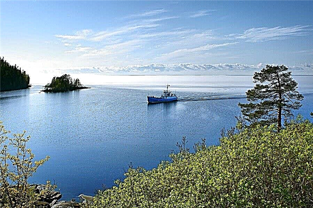
The lakes of Karelia are a popular tourist destination. The number one natural landmark in the region, famous far beyond the borders of the country. A certain microclimate has been created around each lake, which affects the flora and fauna. People come here for different purposes: some admire the beauty, others fish, others want to swim. The growing popularity of lakes affects the development of infrastructure: most are easy and convenient to get to, and there are places to stay nearby. The republic has not yet become a place of pilgrimage for ecotourists, but is gradually gaining ground from other top routes.
The most famous lakes in Karelia
Ladoga
It is located not only in the territory of Karelia, but also in the Leningrad region. The area is 17870 km². The deepest is 230 meters, the average is about 30 meters. There are more than 500 islands on the lake. Sightseeing - Valaam, Konevsky Nativity-Theotokos monastery, Oreshek fortress, Museum "Road of Life" and others. There are hotels and hotels in almost each of the settlements on the coast: the recreation center "Horizon", the cottage complex "Mantiansaari", "Point on the map" and others. Tourism is year-round, but the specificity of the holiday differs depending on the season. The quietest month is July. A regular event is an off-road race around Ladoga.

Onega
It is located on the territory of three regions. The area is 9720 km². The deepest is about 127 meters, the average is about 30 meters. The second largest freshwater lake in Europe. There are cities on the coast, including Petrozavodsk, the Karelian capital. The main attraction is Kizhi. There is a museum-reserve on the island. In the center of the architectural ensemble there is a churchyard built in the 18th century. The church, which has two dozen domes and accompanying structures, is part of the world heritage. Another value of the lake is the Onega petroglyphs. Hotels nearby: "Onega Castle", "Fregat", "Karelia", hostel "Otdykhni" and others.

Janisjärvi
It is located in the Sortavalsky region and is part of the Ladoga basin. The area is 174.9 km². The greatest depth is 57 meters, the average is about 12 meters. There are 43 islands of different sizes on the lake. Approximately 20 rivers flow in, the Janisjoki flows out. The water is fresh, covered with ice from November to May. The main tourist destinations are related to fishing and outdoor recreation. There is a recreation center of the same name near the lake.

Vodlozero
It is located in the Pudozh region. It is a reservoir. It is part of the national park of the same name. The area is 334 km². The greatest depth is about 16 meters, the average is about 3 meters. Two rivers flow out and flow in. There are about 200 islands on the lake, mostly small. The largest is Kanzanavolok, covering an area of 6.2 km². A recreation center has been built nearby, where conditions for fishing are created.

Vygozero
It is located in the Segezha region. The reservoir was formed in 1933. The area is 1143 km². The deepest is 18 meters, the average is about 6 meters. The shores are mostly rocky, high on the north side, slightly lowered on the south. Suitable for families. You can rent a house or rent a room at the Topaz-Kola Hotel, but it is located further from the coastline. A popular navigable tourist route runs across the lake.

Segozero
It is located on the territory of two districts at once: in Segezhsky and Medvezhyegorsky. The area is 815 km². Maximum depth - 103 meters, average - 29 meters. It is connected with Vygozero by the Segezha River. The banks are rocky, the water is clear. There is a trout farm. Fishing is an important element in attracting tourists. Rafting on local rivers is the second most popular outdoor activity. The best place to stop is the tourist base of the same name.

Keret
Located in the north of Karelia. It is connected to the White Sea by the river of the same name. The area is 223 km². The deepest is 26 meters, the average is just over 5 meters. Mostly shallow near the coast, it warms up well in summer, which distinguishes the lake from its neighbors. The coastline is winding, so there are many bays, bays, isolated areas and islets. Places for winter fishing are equipped. You can stop at the Keret camp site.

Marble (Ruskeala)
It is located in the Sortavala region. It is a flooded marble quarry. Its walls are high, and a dense forest grows on the tops. Due to the color of the stone (smooth transitions and washed out white), the picture is picturesque. A tourist road with a fence has been built around. The itinerary of the excursions may vary depending on the season. Hotels nearby: hostel "King of the Hill", the recreation center of the same name, guest house "Uyut" and others.

Sandalwood
It is located in the Kondopoga region. It is connected by a channel with Lake Onega. The area is 152 km². The greatest depth is 58 meters, the average is almost 10 meters. Due to the construction of two dams, it became a reservoir, and the watercourse also changed. Lychny Island is notable. There is a church of Peter and Paul. The best vacation on the lake is in the camping of the same name, which has everything you need for fishing. "Sandal" is located near the village of Sopokha.

Syamozero
Located in the south of the republic. The area is 266 km². The deepest is about 24 meters, the average is slightly less than 7 meters. The lake is flowing, the water level changes depending on the season, but insignificantly. There are many settlements on the coast. People come here for boating and fishing. There are more than 20 species of fish. There are convenient parking lots and places for tents. The hotels are mostly at a distance, including the "Rainbow".

Palleozero
It is located in the Kondopoga region. The area is approximately 100 km². The deepest is 74 meters, the average is 18 meters. In the middle of the lake there is an island named Bolshoi. There are seven more islets smaller in diameter. The bottom is muddy, while the water is clean. In addition to fishing, tourists are attracted by wide sandy beaches and clean pine air. You can stay in a guest house or at the "Tikhy Bereg" recreation center.
![]()
Topozero
It is located in the Loukhsky district. The area is 986 km². The deepest is 56 meters, the average is about 15 meters. Due to the unevenness of the coastline, many bays have been formed. The islands are concentrated mainly on the western and southern coasts. There are more than 140 of them, very different in shape and area. These places attract kayakers. You can stay at the recreation center on the shore, guest houses are also rented.

Pyaozero
It is located in the Loukhsky district. It is part of the reservoir. The area is 659 km². The deepest is 49 meters, the average is about 15 meters. The banks are divided into sections: stone and sand. The forest comes pretty close to the water. There are 66 islands in total. Large ones are built up with houses for fishermen. The second most popular trade is berry picking. In summer, the water is quite warm for the region. You can stop at the Big Dipper.

Kuito
Three lakes under one name. They are located in the Kalevala region. The area is 257 km². The greatest depth is 34 meters. A popular area for fishermen and kayakers. The lakes are connected through the channels and are used for timber rafting. Middle and Lower - parts of the reservoir. Between them is Luusalmi - a small village. Hotels nearby: "Velt", "Sadovoy", "Polar Star".

Engozero
It is located in the Loukhsky district. The area is 122 km². The deepest is 18 meters, the average is about 4.5 meters. Most of the 144 islands are located in the western part of the lake. There are sandy beaches. All around the woods. Kayakers choose this area because of the well-located water route leading to the White Sea. Accommodation is possible at the camp site of the same name or in hotels at a distance.

Seletskoe
It is located in the Medvezhyegorsk region. The area is about 62 km². The average depth is within 17 meters. Three large rivers flow in, one flows out.The banks are heterogeneous in relief, the southern one is much lower and smoother than the others, while the western and eastern ones are covered with hills. There are islands, the most famous is Tortuga. You can stay in the immediate vicinity of the lake by renting one of the huts at the fishing hut.

Nuke
Located in the northwest of the republic. The area is almost 211 km². The deepest is 40 meters, the average is about 9 meters. Translation of the name - Swan. The outlines of the lake are ragged: wide sweep, uneven coastlines and numerous bays. There are over 120 islands. The muddy bottom is complemented by coastal vegetation in some areas. The best place for accommodation is the tourist village "Nageus".

Lososinskoe
It is located in the Prionezhsky region. The area is 10.5 km². The deepest is 7.5 meters, the average is about 3 meters. The water is clear, but its color can be misleading: it changes from yellow-brown to dark. The reason is silt at the bottom and algae. There are sandy beaches. A chapel was built in the village nearby. Petrozavodsk is only 18 km away, so tourists often stay in hotels in the capital of Karelia.

Suojärvi
Located in the southwest of the republic. Area - 58.5 km². The greatest depth is 24 meters, the average is about 3.5 meters. Translation of the name - Bolotnoye. The water level changes significantly in different seasons. Connected with Lake Salonjärvi through a channel. Some areas have ore deposits. On one of the banks there is a city of the same name. Hotels: "House on the Lake", "Karelia", "Comfort" and others.

Pisa
It is located in the Muezersky district. Area - 0.8 km². There is no depth map. Translation of the title - Longest. It is a reference in form - an extended rift filled with water. The shores are picturesque and high, in some areas they reach hundreds of meters. The main tourist flow is photographers and rock climbers. The lake belongs to the mountains, there are no hotels and infrastructure for travelers nearby.

Urozero
Located in the southern part of Karelia. The area is about 13 km². The greatest depth is 35 meters, the average is 12 meters. Another name is Light. It is part of the reserve. It is connected with Ukshozero through a stream. It is famous for its clear water - up to 15 meters in calm and clear weather. There is a sandy beach. An extensive camp site with a bathhouse, places for barbecues, guest houses was built right on the shore.

Kukas
It is located in the Loukhsky district in the territory of the national park. The area is about 40 km². Located surrounded by hills. The forest is dense, the vegetation is varied. The banks are partly rocky, there are admixtures of granite and marble. The transparency of the water reaches 20 meters. The path to the lake is off-road, it is better to choose a walking route or leave the car at the track. There are no hotels and cafes nearby.

Shotozero
It is located in the Pryazhinsky district. The area is 74 km². The deepest is 10 meters, the average is 3 meters. There are 43 islands on the lake. Shuya flows through it, which feeds the reservoir. The bottom is partially covered with ore deposits. There are 16 species of fish, fishing is the main reason for tourist trips here. You can stop at a tourist center or a hotel located on the nearby Syamozero.

Ondozero
Located in the central part of Karelia. The area is approximately 182 km². The greatest depth is 8 meters, the average is about 3 meters. The Onda River flows through it. The coastline is meandering, so bays and bays are formed. The water level varies within two meters. There are over 50 islands. The largest is Teronshari. A popular place for tourists to stop is fishing and hunting lodges.

Pertozero
It is located in the Kondopoga region. The area is about 15 km². The greatest depth is 37 meters, the average is 11 meters. It is a reservoir, and one of the oldest in the country. Previously, a plant operated here, whose needs were served by Pertozero. Suitable for fishing, but you must have experience and appropriate gear to catch a good catch. A popular tourist destination is the Aleksandrovka Village.

Kroshnozero
It is located in the Pryazhinsky district. The area is 9 km². The greatest depth is 12.5 meters, the average is 5.5 meters. The southern coast is suitable for a beach holiday, as it is covered with sand. However, the water does not warm up above 19 degrees. Nearby is the Korzinskaya ridge, and at its foot is a spring with the highest quality drinking water in the region. There is a tourist base of the same name. The main contingent is fishermen and hunters.

Tiksheozero
It is located in the Loukhsky district. The area is 209 km². The deepest is 40 meters, the average is 8 meters. The shape of the reservoir resembles a shamrock. There are 342 islands, the largest of which is Kaigas. The banks are heterogeneous and steep in places, their height reaches 15 meters. Several rivers flow in and out, including the Lopskaya, which flows through the lake. Rental housing options are the Tiksha and Tiksheozero guest houses.

Leksozero
It is located in the Muezersky District. The area is 166 km². The greatest depth is 34 meters, the average is about 8.5 meters. It is powered mainly by melting snow and precipitation. For the winter it is covered with ice, in the summer it warms up well. The water has a yellowish tint, but no smell or taste. There are 14 fish species. Forest houses have been built on the shore, which can be rented by the day.

Pyhäjärvi
It is located on the territory of Russia and Finland, and most of it is under the jurisdiction of its northern neighbors. The area is approximately 207 km². The greatest depth is 80 meters. Crossing the border here takes place according to all the rules, an exception is made for cars with forest, for which special checkpoints are open. Rental housing options - cottages and guest houses. It is difficult to get to the lake from the Russian side - there are barriers.

Tolvojärvi
Located in the western part of the region. The area is 8.5 km². The greatest depth is 10 meters, the average is 4 meters. There are 23 islands on the lake, and Kottisaari is larger than all the others combined. The area became famous during the Winter War, and then during the Second World War. There are several hotels, a guest house "Tamara", a bath complex and so on. There is a marble quarry nearby.


